Allegan County 1928, Fennville Quadrangle
Map
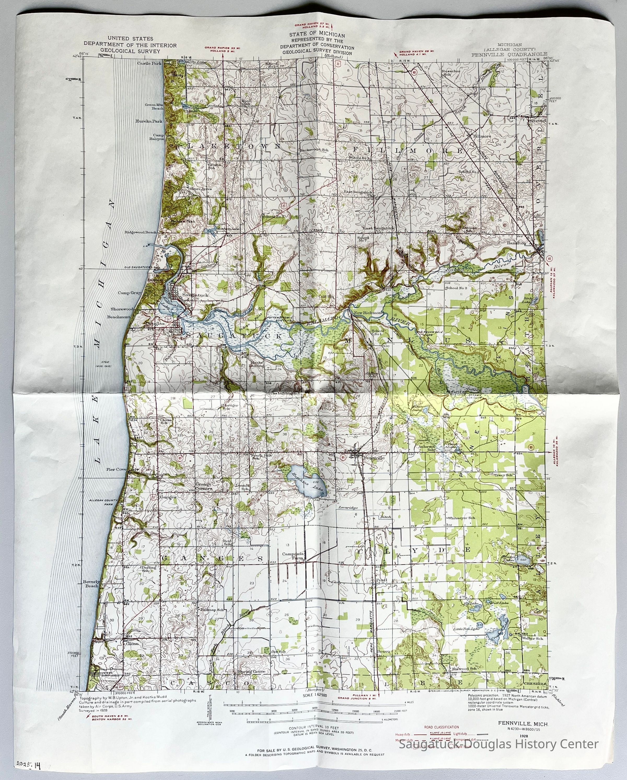
Highly detailed, 5-color USGS quadrangle map of Fennville covering Laketown, Fillmore, Saugatuck, Manlius, Ganges, and Clyde townships. This is the second copy of this map in collection but it is not laminated and was folded. The map is rich in detail, showing buildings, school locations, roads with classification styles, land contours and place names.
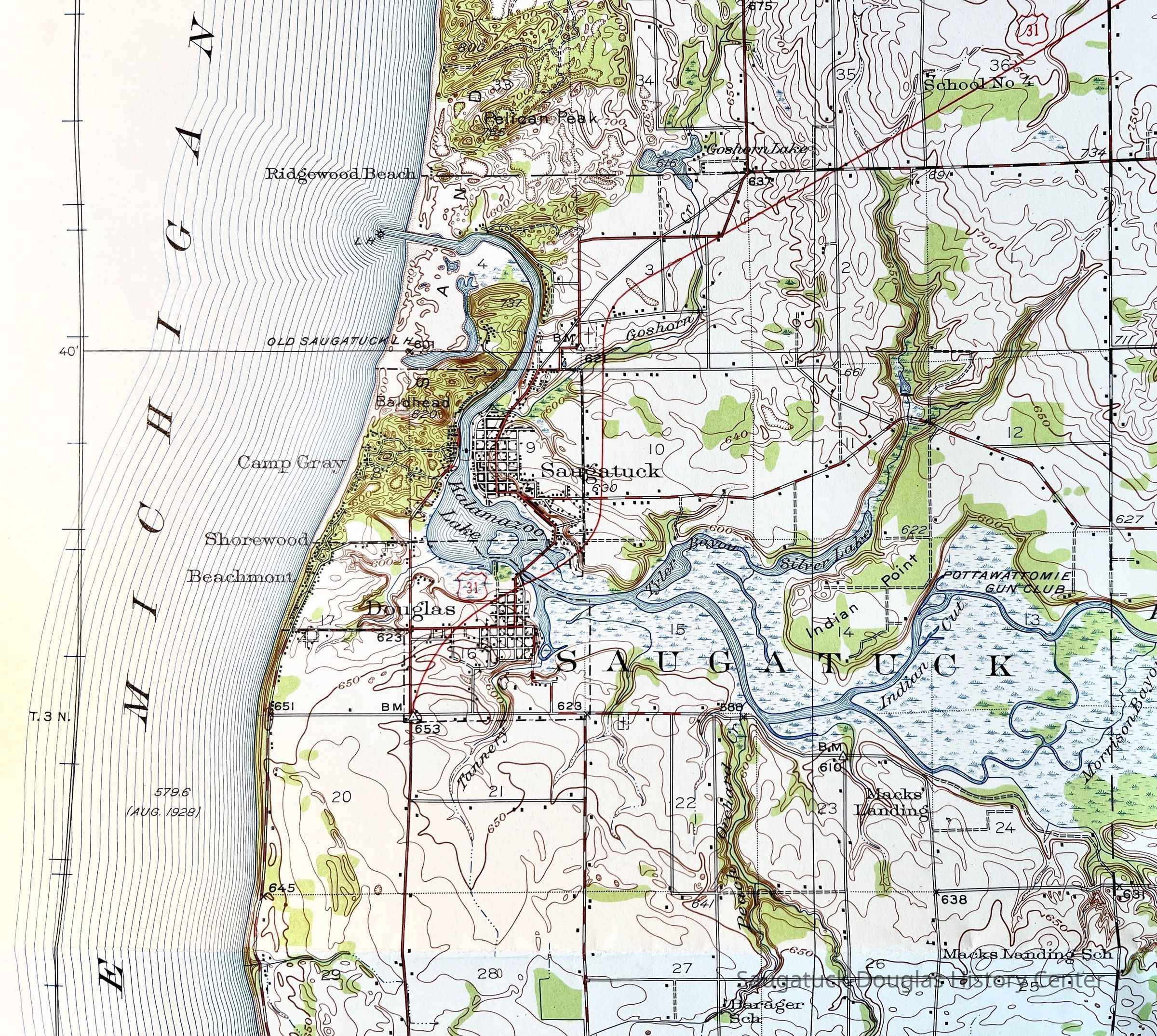
2025.14.01
Indicates locations of Gibson School, Carver Drain, Camp Halcyon, Pelican Peak, Shore Acres, School No. 4, East Saugatuck, Ridgewood Beach, Old Saugatuck Harbor and new channel mouth, Camp Gray, Shorewood, Beachmont, US 31, Tannery Creek, Chase School, Barager School, Pier cove, Beach Beld School, Loomis School, Macks Landing Schook. Mack Landing Peach Orchard Creek, Indian Cut, Indian Point, Morrison Bayou, New Richmond, Pottawattomie Gun Club, Colf School, Silver Lake, Tyler Bayou, Rabbit River, Old Squaw Skin, Pere Marquette railroad, Little Dailey Bayou, Campania Farm, and more.
Maps
Education and schools
Transporation: Rail - other than Interurban
2025.14
United States Geological Survey
1:62500
Fennville, Michigan
Conic
United States Geological Survey
1928
22 in
18 in
Flat Files drawer 11 Local maps