Aerial 1955
Photograph
24"x24" black and white aerial photograph of the Saugatuck Harbor taken on September 2, 1955. According to James T. Fassen this was taken as a stereoscopic image to capture additional elevation information. A code in the upper right corner is AIV-3P-136. Douglas is still dotted with orchards and large swaths of land are undeveloped.
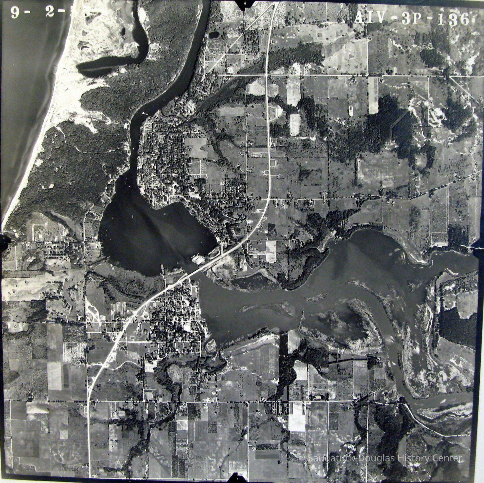
2016.17.01
Print, photograph
Tara Restaurant/Spencer House/200 Center
River Queen Boatworks/81. N Ferry/Harbor Club/Harding Hotel, 2nd
Pier Marina/Saugatuck Marine 1947-1970s
Saugatuck Fruit Exchange 1917-1956
Big Pavilion 1909-1960
This map is significant for all it does not show: no I-196, Tower Marina or 2024 High School.
1870 Fruit growing, farming, agriculture
Development, land
2016.17
Bella, Victor "Vic"
Donation
1955
24 in
24 in
Flat Files drawer 15 photos
Good
Status: OK Status By: Mary Voss Status Date: 2016-05-04