
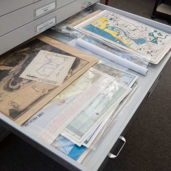
Online Catalog
You can visit the History Center Archives in person to learn what’s in our collection, but much of the material is now indexed in the CatalogIt Hub. On this page, you can browse through several sets of items or use a search box to look for something specific in the collection.
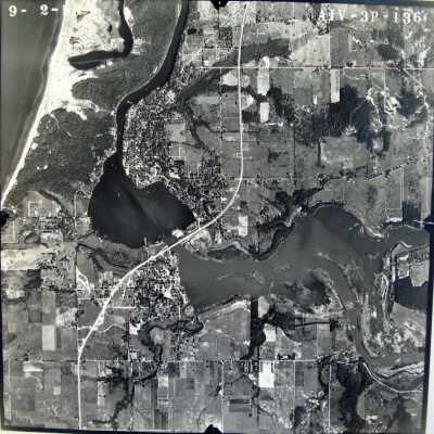
Aerial 1955
24"x24" black and white aerial photograph of the Saugatuck Harbor taken on September 2, 1955. According to James T. Fassen this was taken as a stereoscopic image to capture additional elevation information. A code in the upper right corner is AIV-3P-136. Douglas is still dotted with orchards and large swaths of land are undeveloped.
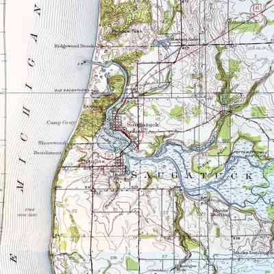
Allegan County 1928, Fennville Quadrangle
Highly detailed, 5-color USGS quadrangle map of Fennville covering Laketown, Fillmore, Saugatuck, Manlius, Ganges, and Clyde townships. This is the second copy of this map in collection but it is not laminated and was folded. The map is rich in detail, showing buildings, school locations, roads with classification styles, land contours and place names.
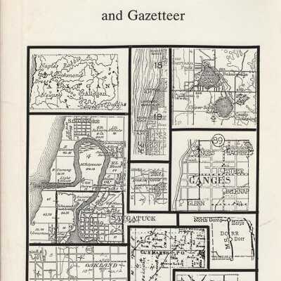
Allegan County Historical Atlas and Gazetteer
All you ever wanted to know about Allegan County, Michigan. This book includes historical maps from 1829 just before the first settlers arrived through the building of the Interstate Highway System. Railroads, both steam and electric, with a few horse-drawn also included, are covered in one section and bodies of water in another. Also a brief history of settlement, a county bibliography, an essay about fictional books set in the county, and a township by township gazetteer of all settlements that ever existed. 192 pages : maps ; 27 cm
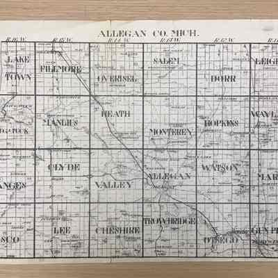
Allegan County Map 1956 Hixson
Map of Allegan County divided into townships and sections. Map shows U.S., state, and county highways.
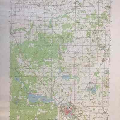
Allegan Quadrangle Map
USGS quadrangle map of Allegan covering Overisel, Salem, Heath, Monterey, Valley, and Allegan townships.
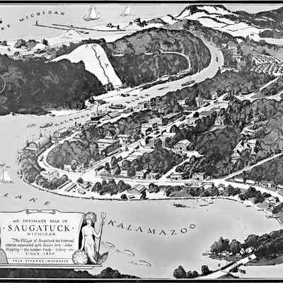
An Intimate Map of Saugatuck
A black and white version of the birds-eye view of Saugatuck designed by Fred Stearns. Map is mounted on cardboard. Map has a decorative title box in the lower left corner adorned with a stereotypical "Indian maid" and mermaid. The map shows both old and new channels, boats on the lake and river, the swing bridge, a very bare Mt. Baldhead with people leaping down the slope, Ox-Bow, Goshorn lake, orchards, the Big Pool, the Big Pavilion, the lumberyard and buildings on Butler Street and many other charming details.
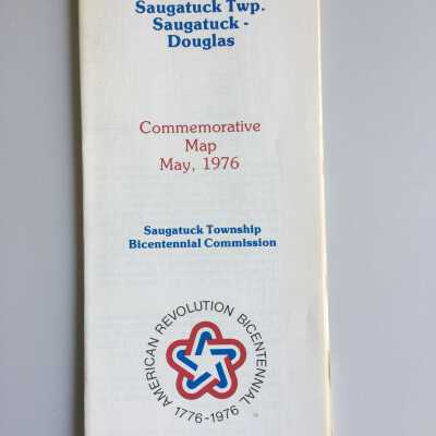
Bicentennial Commemorative Map May, 1976
Bicentennial map of Saugatuck, Douglas and Saugatuck Township. 22 x 35" on the reverse side are historical photos of the area.
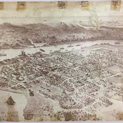
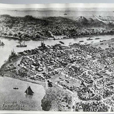
Bird's-eye drawing Saugatuck 1907
Reproduction of the Joseph Warner's bird's eye map of the Village of Saugatuck 1907
Bird's-eye view of Saugatuck Flats 1907
Photographic exhibit #2 from legal complaint filed on June 20, 1967 in Allegan County by plaintiffs Walter and Elizabeth Coburn, [proprietors of the Ship 'N Shore Hotel/Motel/Boatel] vs. defendant Kalamazoo Ferry Company [Peterson] about the trimming of vegetation and installation of pilings by the eastern Chain Ferry landing. Yellow Plaintiff's Exhibit sticker on back of photo is dated 3-26-68. This is a reprint of a historic drawing of Saugatuck's riverfront. It does not show Saugatuck in the mid-'60s. Reproduction of the Joseph Warner hand-drawn birds eye or aerial map of the Village of Saugatuck 1907