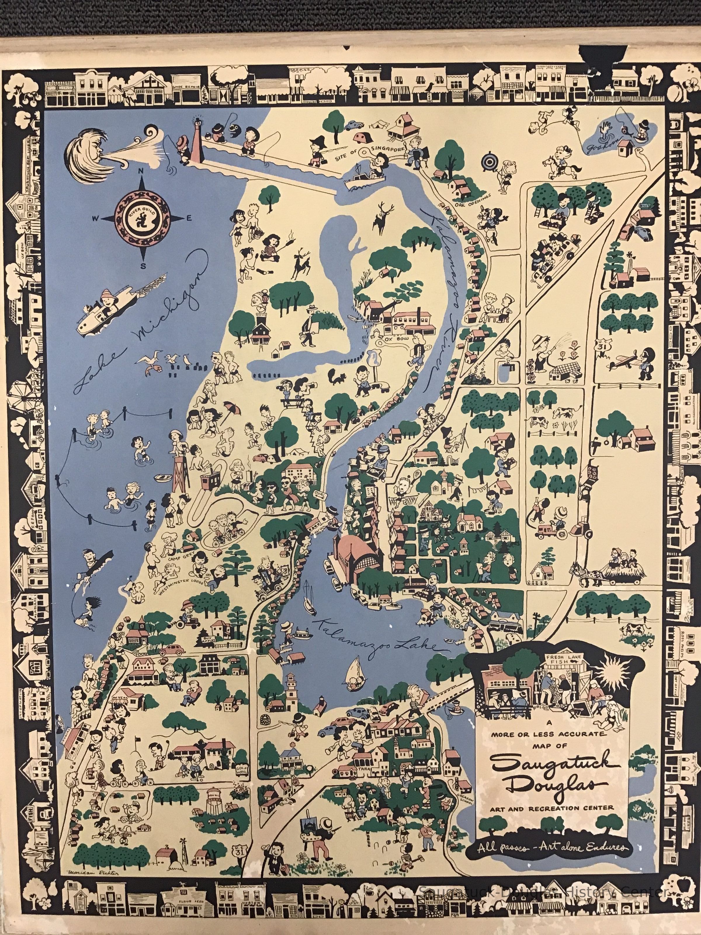
A more or less accurate map of Saugatuck Douglas

2023.18.38
Map Room OSH
J.Petter/Joyce Petter Gallery/Gray Gables/River Guild
Whimsical map of Saugatuck ca 1948 One of the recent donations to the Saugatuck-Douglas Historical Society archives is a framed colored map of Saugatuck Douglas from the 1940s. If you have ever been in the Auction House restaurant in Douglas there is one like it by the door as your leave. It is very nicely done with little drawings all over it depicting buildings and activities. It shows the old Big Pool north of town, and on a site near there where a home stands now it shows Chinese money plants growing. They still bloom in that spot every year. The poster is signed by Maridan Richter and has the insignia of River Guild, an association of artists and craftspeople that opened a workshop and gallery in an old lumber company building in Douglas, later Gray Gables, now Joyce Petter Gallery. The map was found in the basement of the residence of Rev. Joe Hills at Presbyterian Camps. This map and several others: a 1928 version by Fred Steams, a 1966 edition by Henry Niles, two different illustrated maps published in 1969 and 1973 by Deb Hoffman, a 1982 colored map done by Bob Carey and a 1984 map by Martha Severt will be included in this summer's exhibit on Saugatuck art. There will also be a wood block map of Western Michigan done by Hollyhock House proprietor Emily Lamb and several other specialty maps in the exhibit. source: "Archivist's Corner" by Bill Kemperman, SDHS newsletter inserts, pg. 17
10/25/2023
11/08/2023


