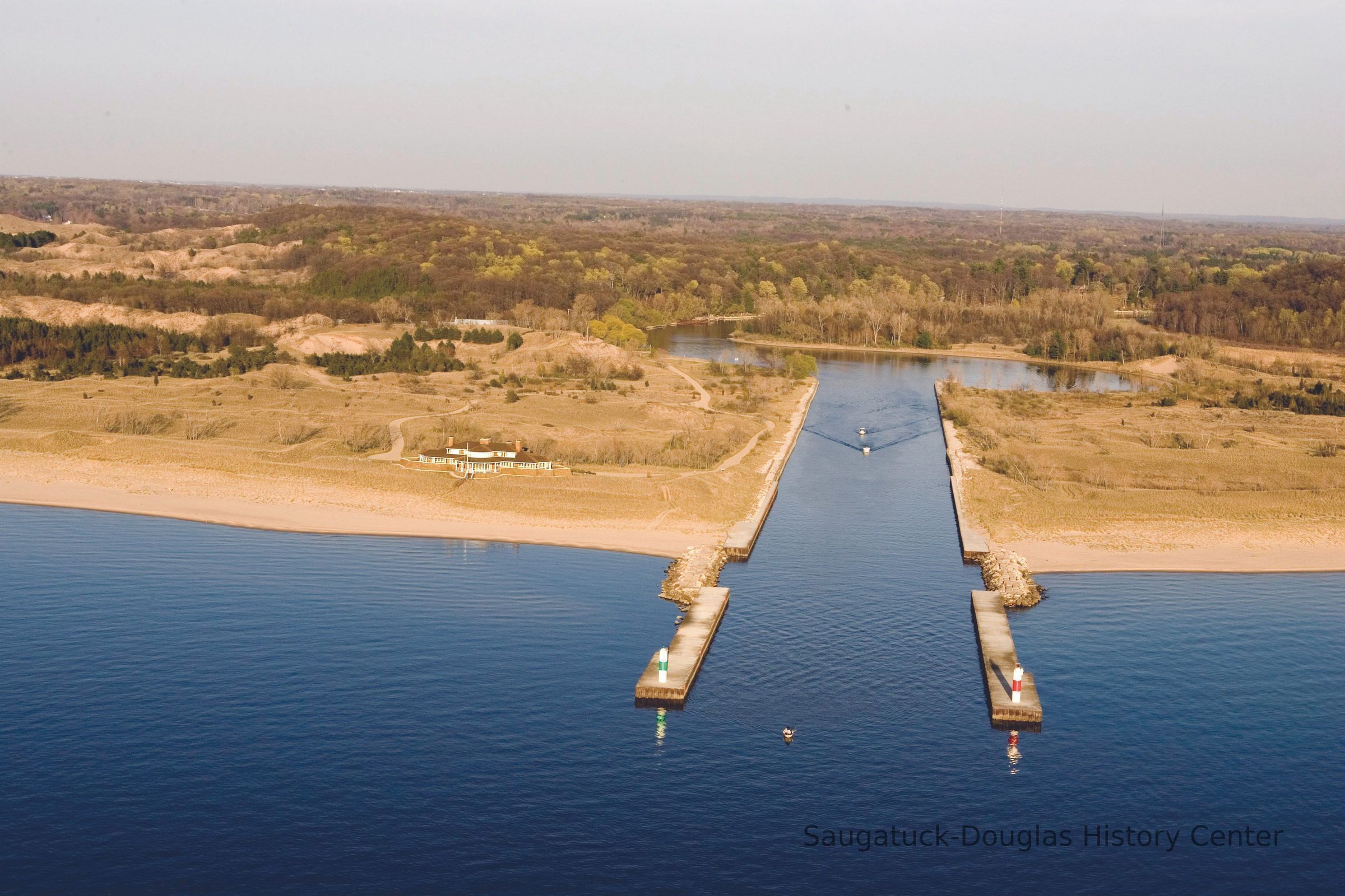
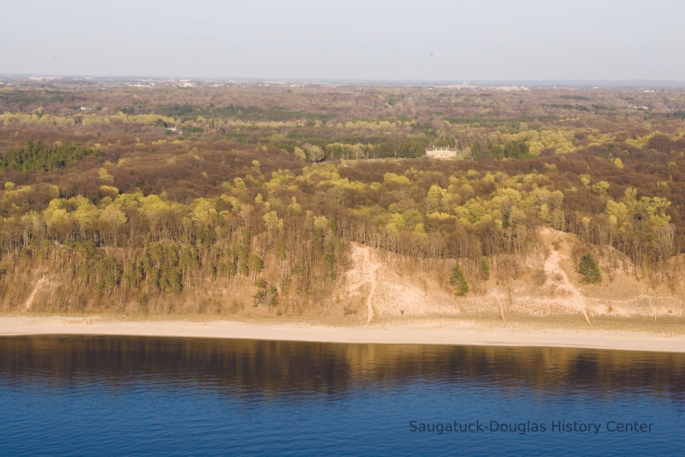
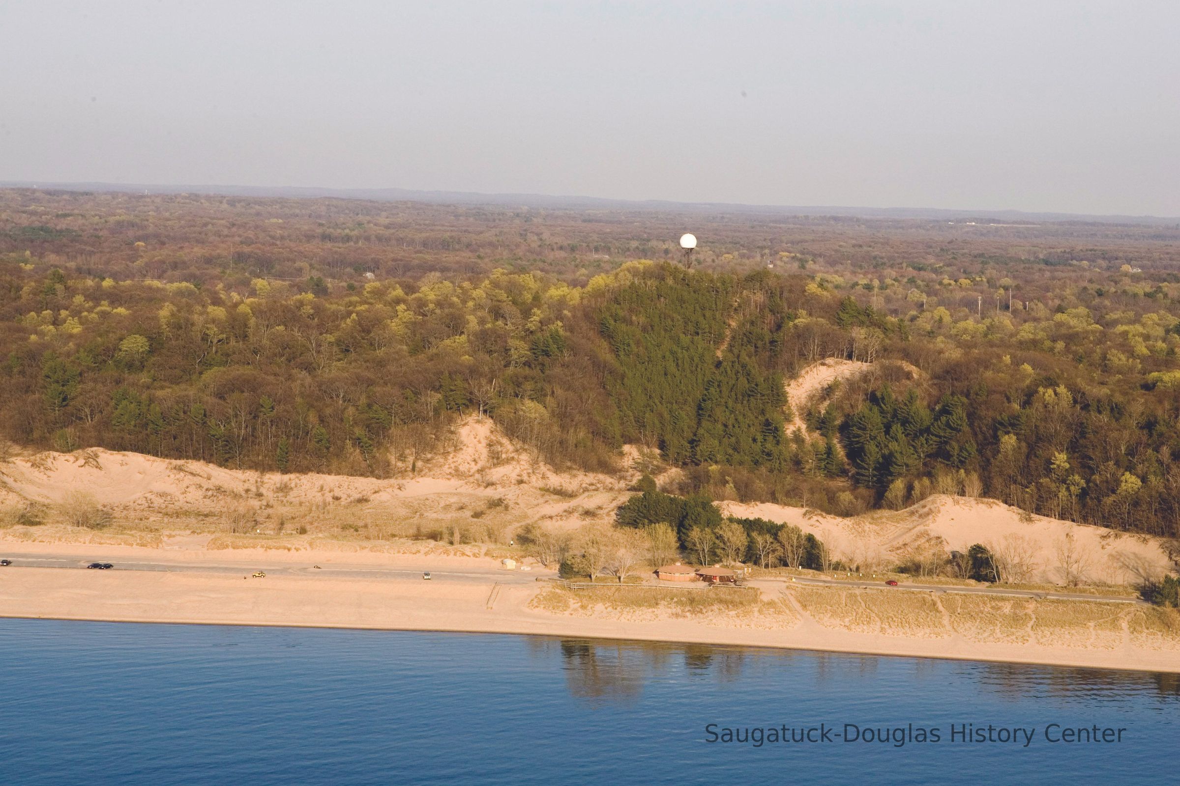
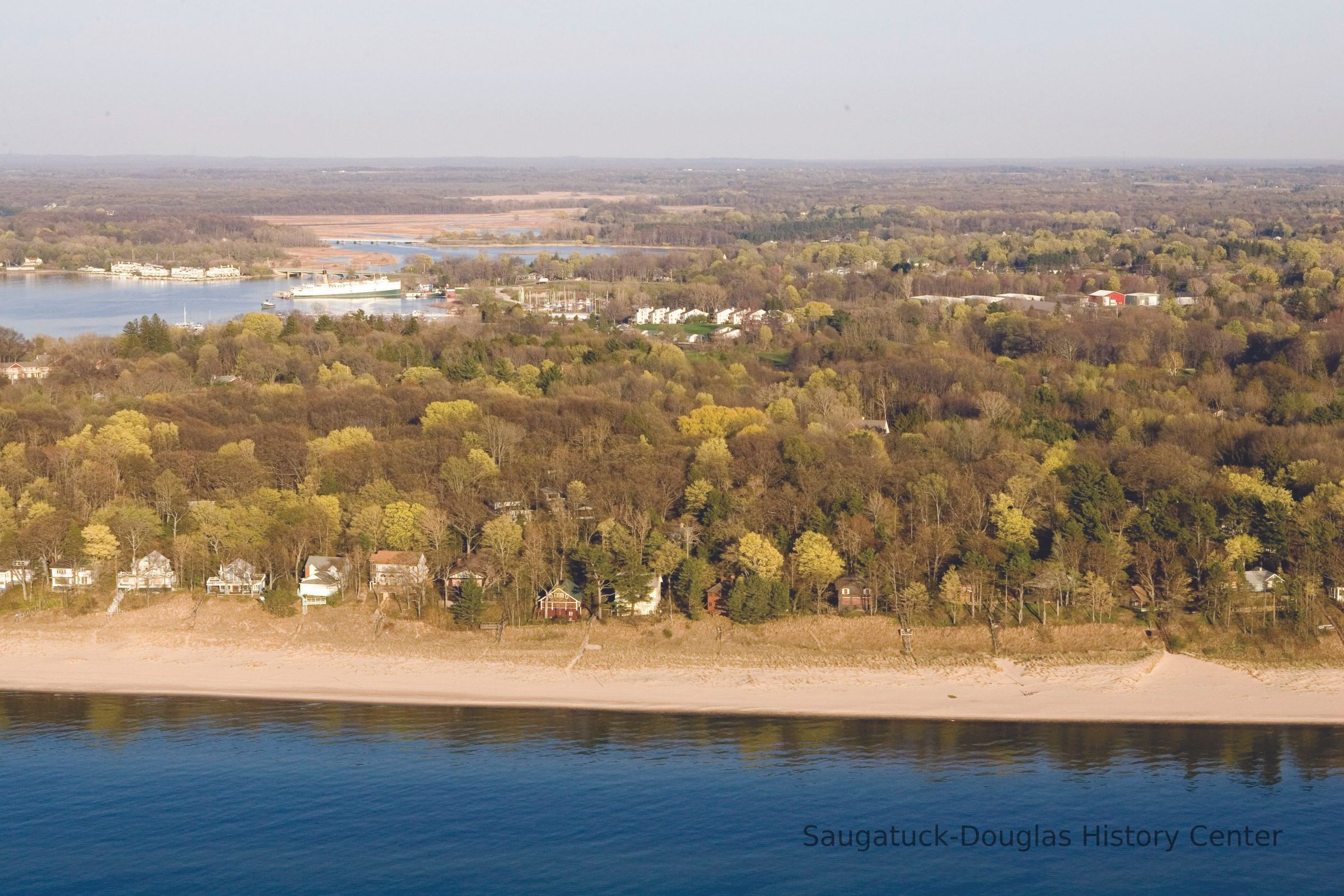
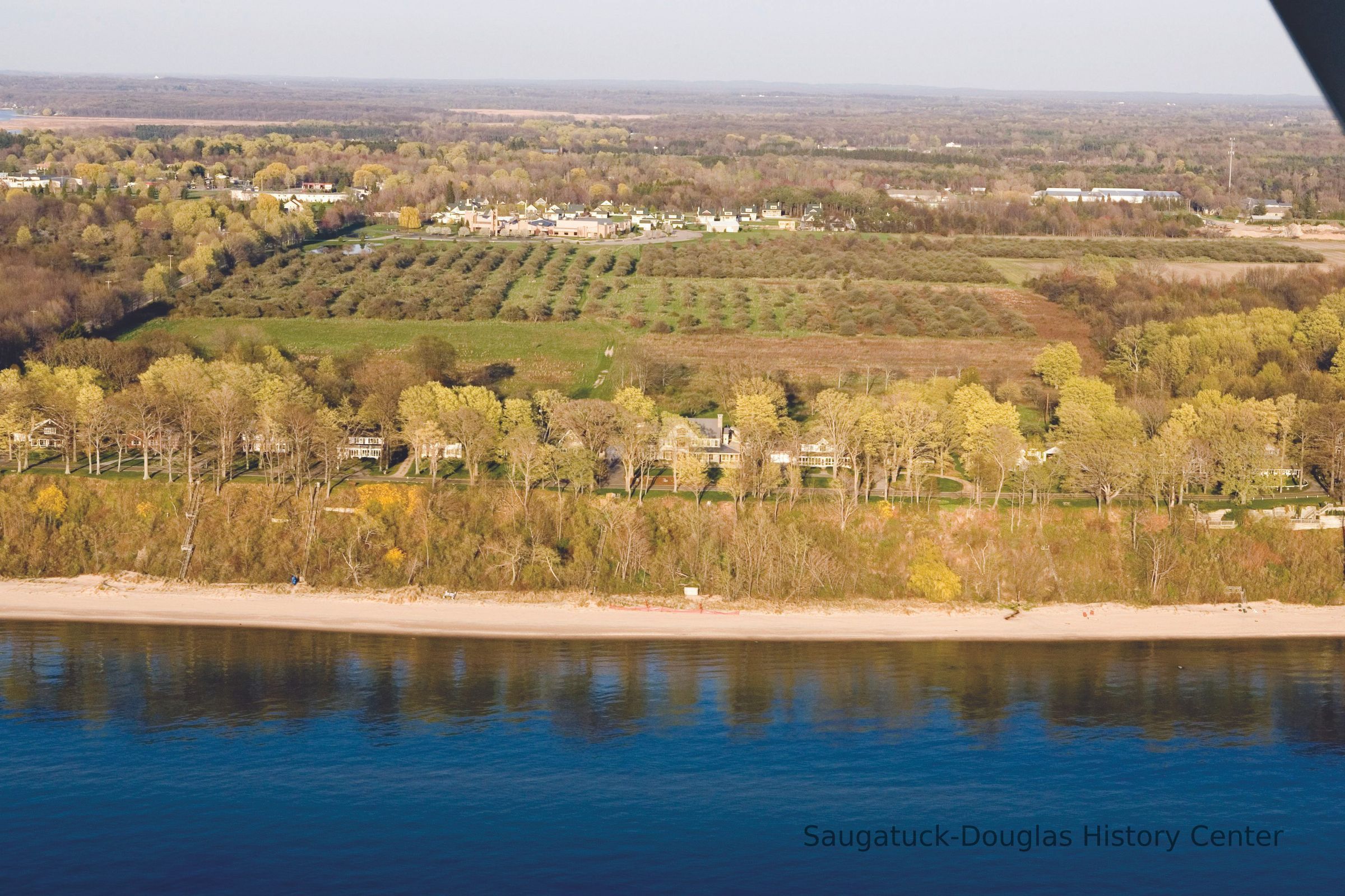
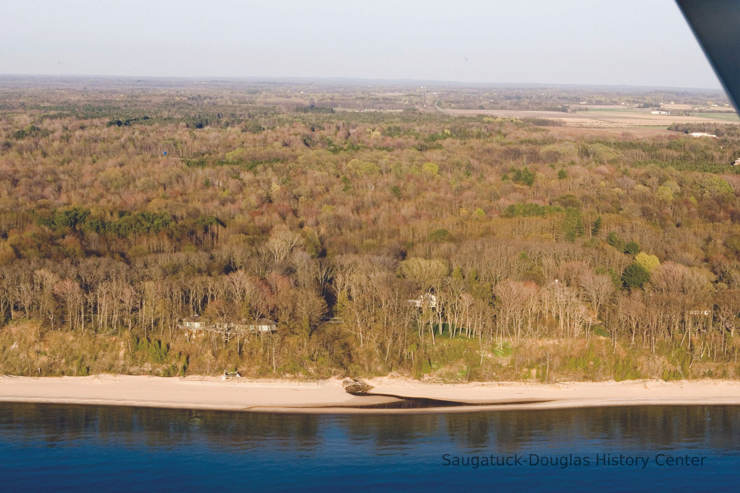
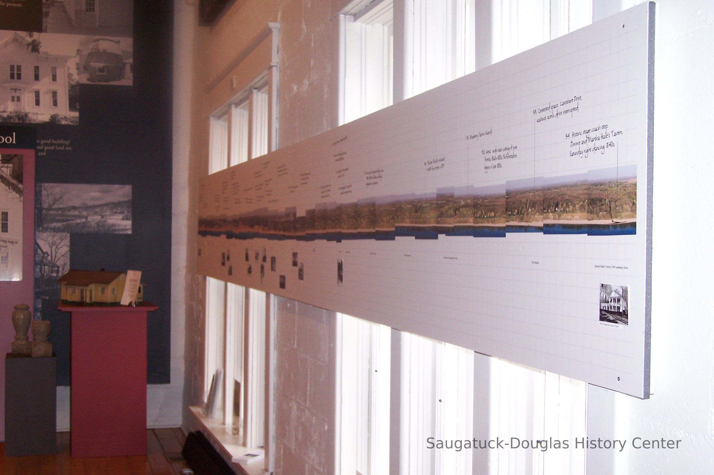
Lakeshore from the air 2006
Photograph
CD containing 33 photos (in .tif and .jpg formats) of the Saugatuck-Douglas coast from the Saugatuck Dunes State Park to the washout south of Wiley Road. The photos were taken by Bill Werme from a plane piloted by Eddie Swane circa 2006.
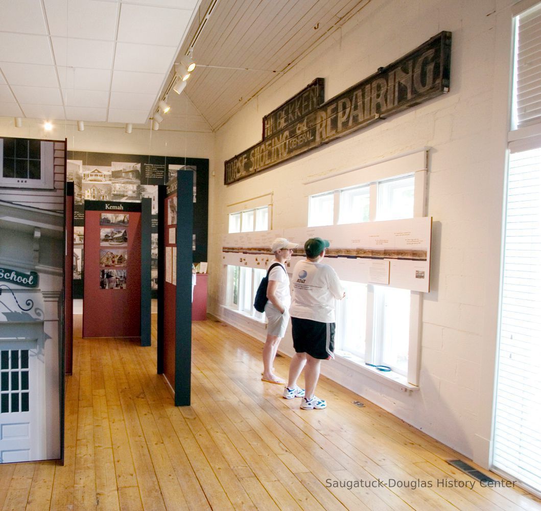
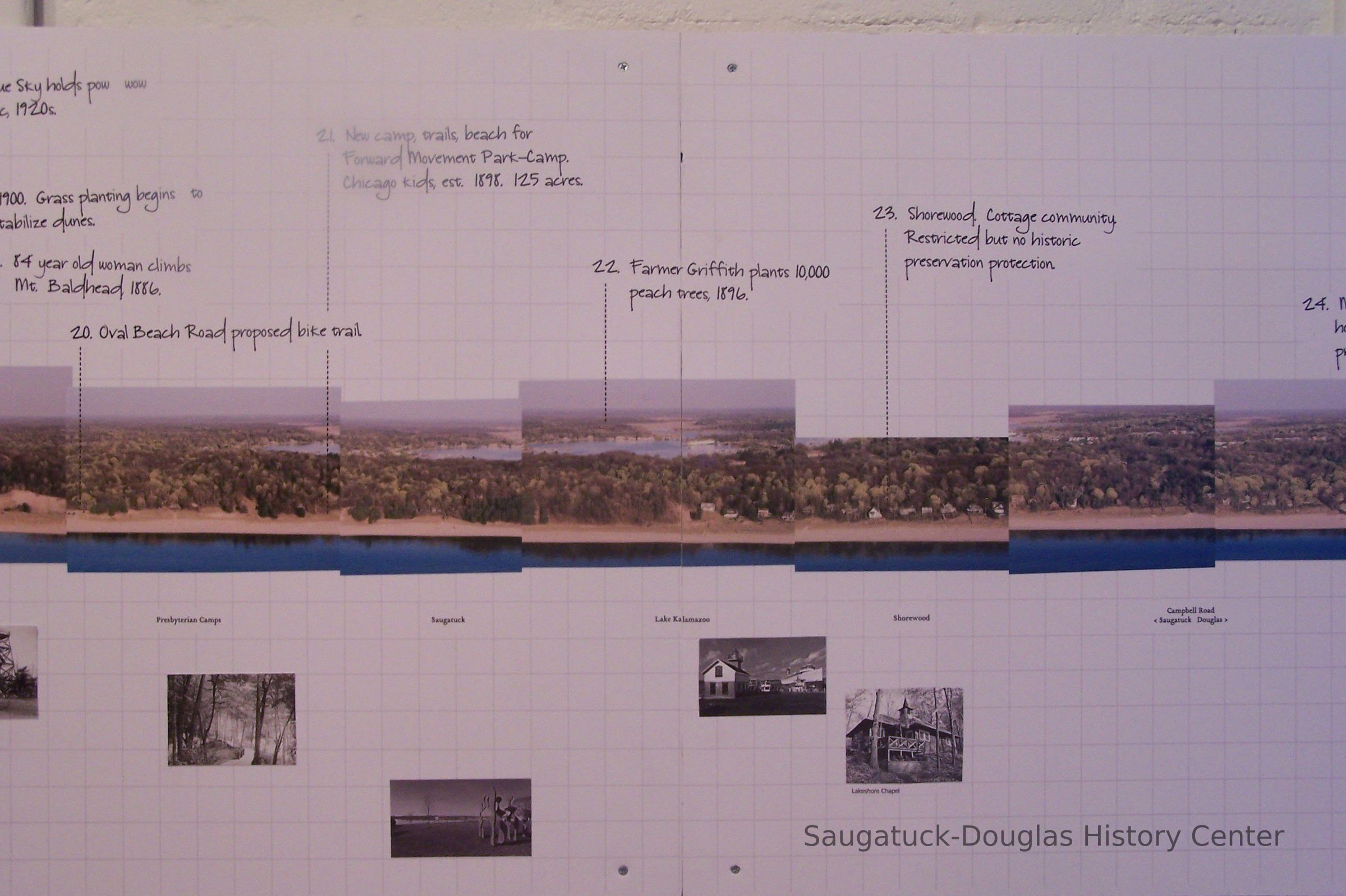
These images were assembled by Rick Vanderleek into a 16-foot aerial panorama photo that was displayed in the 2006 SDHS museum exhibit "Raising the Roof: The Second Story."

2023.18.47
Digital
Mariners Cove & Tower Harbor Marina CondominiumsMount Baldhead Gap-Filler Radar Annex 1956-presentWerme, Bill 1949-Oval Beach 1936-presentOld Harbor/Channel piers pre-1906/Ox-Bow LagoonSaugatuck Harbor Natural Area/South Denison Property/Gay/Nude Beach;Lakeshore Drive, DouglasSaugatuck Dunes State ParkSaugatuck Harbor Piers/Channel 1906-present
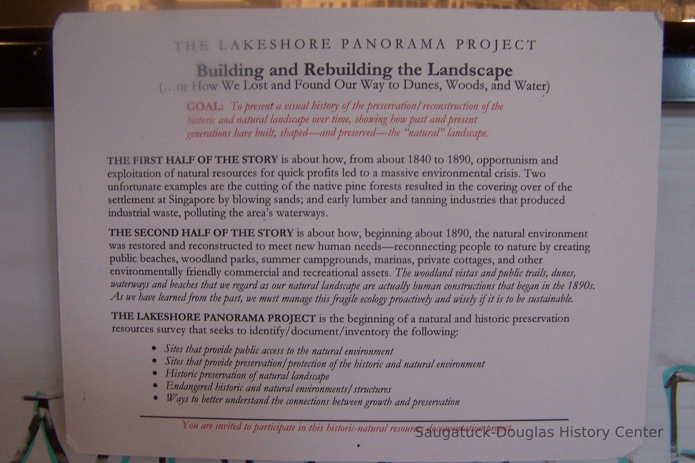
SDHC ExhibitsDevelopment, land1900 Lakeshore community
Winthers, Sally
Werme, Bill 1949-
2006
119 B CDs SDHC Book/Exhibit production
12/03/2023
08/16/2024