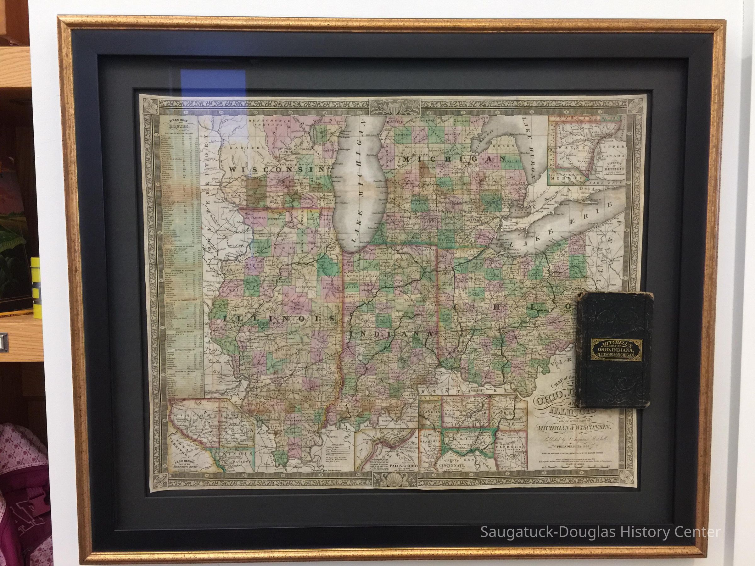
Mitchell’s Map of Ohio, Indiana, Illinois & Michigan
2021.76.11
not including the 3" mat and frame
18 in
22 in
Map Room OSH
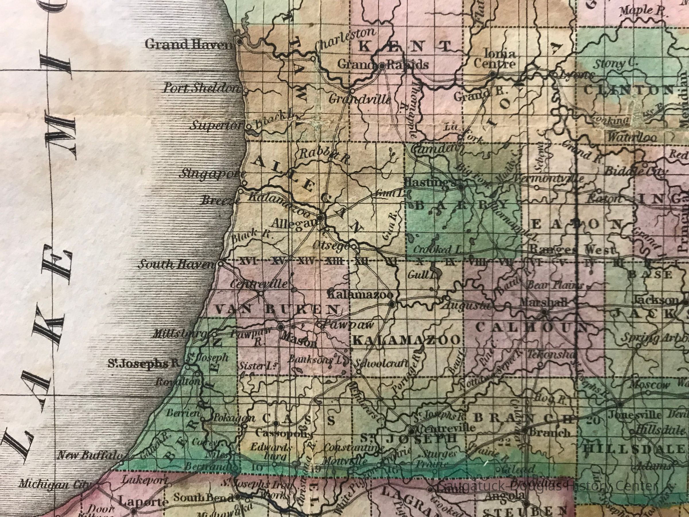
A map that fits in your pocket This traveler’s map of the Midwestern United States once folded into the pocket-sized leather book mounted with it. Printed in 1844 in Philadelphia, the map shows the personal importance of geographic knowledge in the early 19th century, just as you might rely on a smartphone with Google Maps today. Reading maps Look carefully at the map: you may identify the Kalamazoo River and the county seat of Allegan. You may also read the name Singapore, the infamous “ghost town” established in 1836 and abandoned in 1875 near Saugatuck. Also marked is the phantom settlement of Breeze on the south shore of the Kalamazoo River despite no place existing with that name. Neither Saugatuck or Douglas appear on this map. Indigenous people are largely excluded in this representation, exceptions being Anishinaabek place names on the map and a description of “Mennomonie Indians” in Northern Wisconsin. The US Government’s “Indian Removal” policies after 1830 forced many Indigenous people out of the Midwest to reservation lands west of the Mississippi. The rapid pace of expansion across this region was driven by land speculation, lumbering, mining, and agriculture; it also required frequent updates and new editions of maps. The completion of the Erie Canal in 1825, connecting the Great Lakes with direct access to the global port of New York City led to one of the largest migrations in American history. History of the map In 1834, Philadelphia geographer and publisher Samuel Augustus Mitchell purchased the printing plates from A. Finley’s 1825 map of the Midwest region in A New American Atlas. He revised it with newly compiled federal surveys to produce this folding traveler’s map revised with roads, railroads, a table of steamboat routes, and insets of Detroit, Cincinnati, the falls of Ohio, and the Wisconsin-Illinois border. How was this map used? There are a few clues about the history of this map. Handwritten notes inside the cover of the book describe a Great Lakes journey; “Left Joes the 1 March 1856” and “Detroit City Michigan” establish the map’s use in this region. Signs of wear including tears from repeated folding suggest active use for many years. SDHC Collections, gift of Kenneth Kutzel and Bill McGlone. Art conservation and framing supported by the SDHC Friends of Art including Steve Hutchins, Bill Hess and Mike Mattern.
11/30/2021
12/13/2023